
IN SEARCH OF THE GOOSE CREEK CANAL
Story and photos by Chris Wadsworth
By nature, I’m a history buff. I enjoy learning about the past – especially the local past and the history of the places where I live. Before becoming editor of Ashburn Magazine, I wrote three history books about the Florida community I lived in. So, when I heard that ruins of an old canal and stone locks were in the woods along Goose Creek near the Potomac River north of Ashburn, I was intrigued. I wanted to know more about them and to see them for myself.
That was a decade ago. I am nothing if not a procrastinator. But after years of thinking about it, I finally decided to tackle finding this section of old canal hidden so close to home. So, on a cool October morning, I set off on my quest.
I headed to the Bazil Newman Riverfront Park in Lansdowne. (You may recall this used to be known as the Elizabeth Mills Riverfront Park until the county changed the name earlier this year.) I parked in the small public parking lot, walked past a starter’s booth at The Golf Club at Lansdowne and made my way down a golf cart path before veering off into the park. From there, I headed in a northerly direction down a shaded path along the Potomac.
As I hiked, I thought about the canal and what I had learned about it. According to the writings of local historian Eugene Scheel, the official name of the project was the Goose Creek and Little River Navigation Co. Planning and fundraising for a series of canals and locks started in the 1830s, and construction began a decade later.
Part of the delay in finding support for the plans came from concern over the rise of the railroad. There was much debate and hand-wringing over whether canals and rivers would continue to be the primary mode for transporting goods if more railroads were built. Another delay was the 1846 death of the canal company’s president, George Carter. Carter is better known around Loudoun County as the one-time owner of the historic Oatlands property in Leesburg.
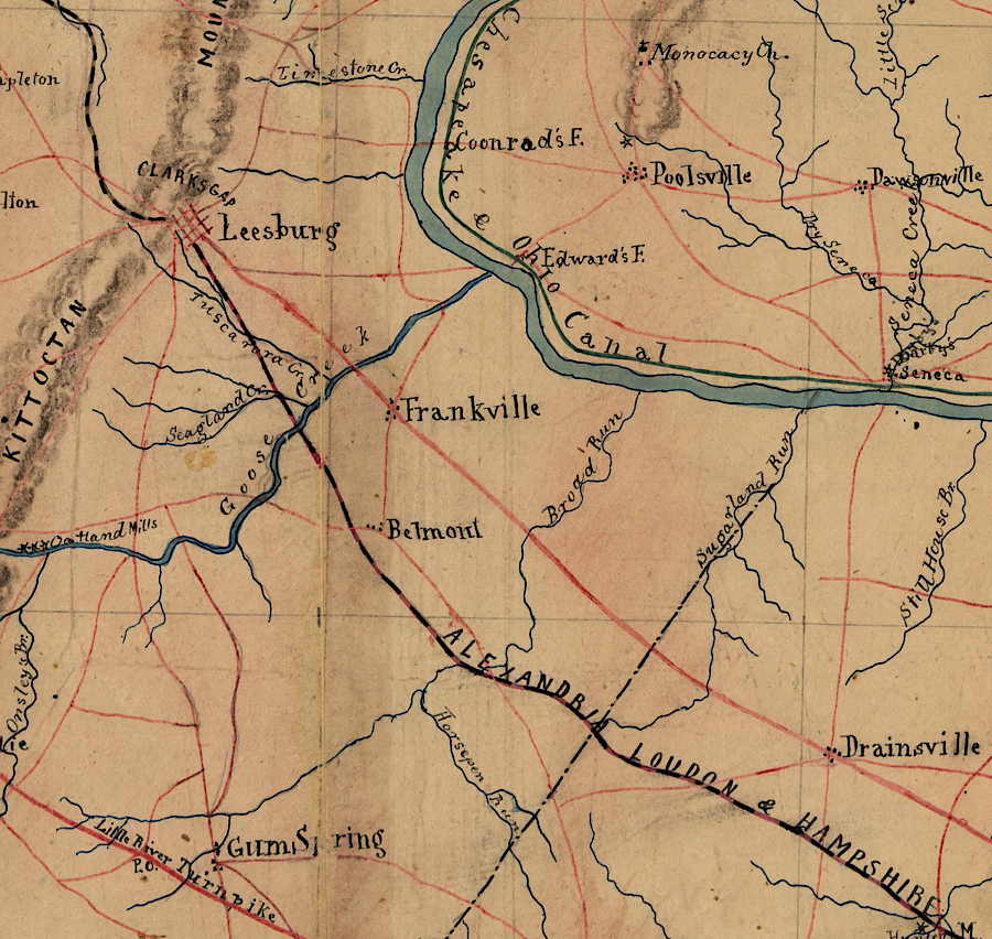
Nevertheless, work eventually got underway. The original goal was to make Goose Creek navigable from the Potomac to several large mills roughly 20 miles away. According to documents in the Library of Congress archives, the idea was to transport goods from landlocked regions of Loudoun, Fauquier and Prince William counties up the Goose Creek to the Potomac, where they could then go upstream a short way and access the C&O Canal on the Maryland side of the river.
Roughly 35 minutes into my hike along the narrow sliver of shoreline woods – the Potomac River to my right, the golf course on my left – I slowly noticed that a depression had formed on my left, between me and the golf course. I was now walking on a ridge of sorts between the river and this tree- and shrub- filled depression. Could this low-lying terrain be part of the abandoned canal I was searching for? The answer – yes, it was.
Within a couple hundred feet, I arrived at a still extant portion of the first Goose Creek locks – a stone-lined waterway that would have helped boats and rafts navigate around an obstacle on the main creek. Heavy rock walls rose from the underbrush – some crumbling away, others still in remarkably decent shape.
Historian Scheel wrote that there was much debate over whether to build the locks from less expensive wood or go with the pricier stone, which would be much more durable. Ultimately stone was selected, and sandstone was transported from nearby quarries. To make up some of the cost, the length of the locks was shortened from the original plan.
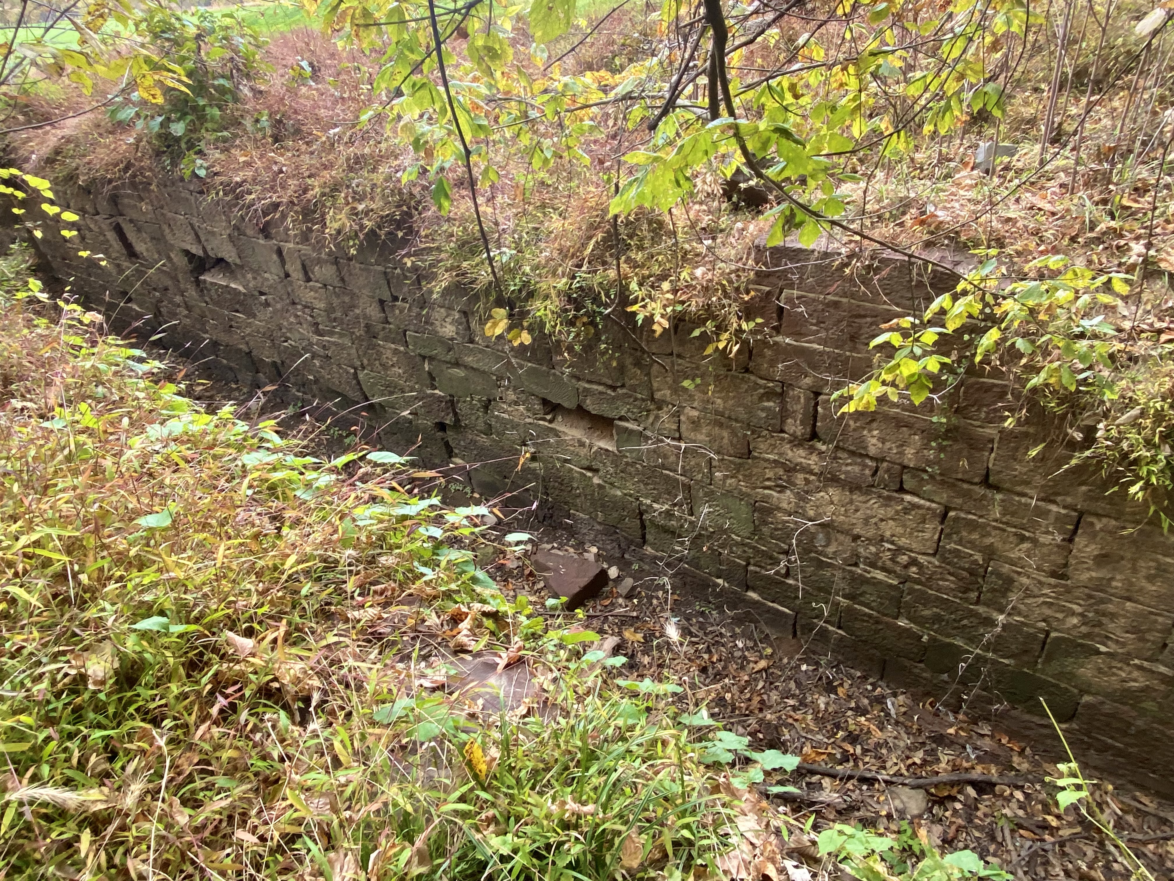
If I could reach back through time and speak to those early builders, I would tell them mission accomplished. The locks they created about 170 years ago are still here – or at least part of them.
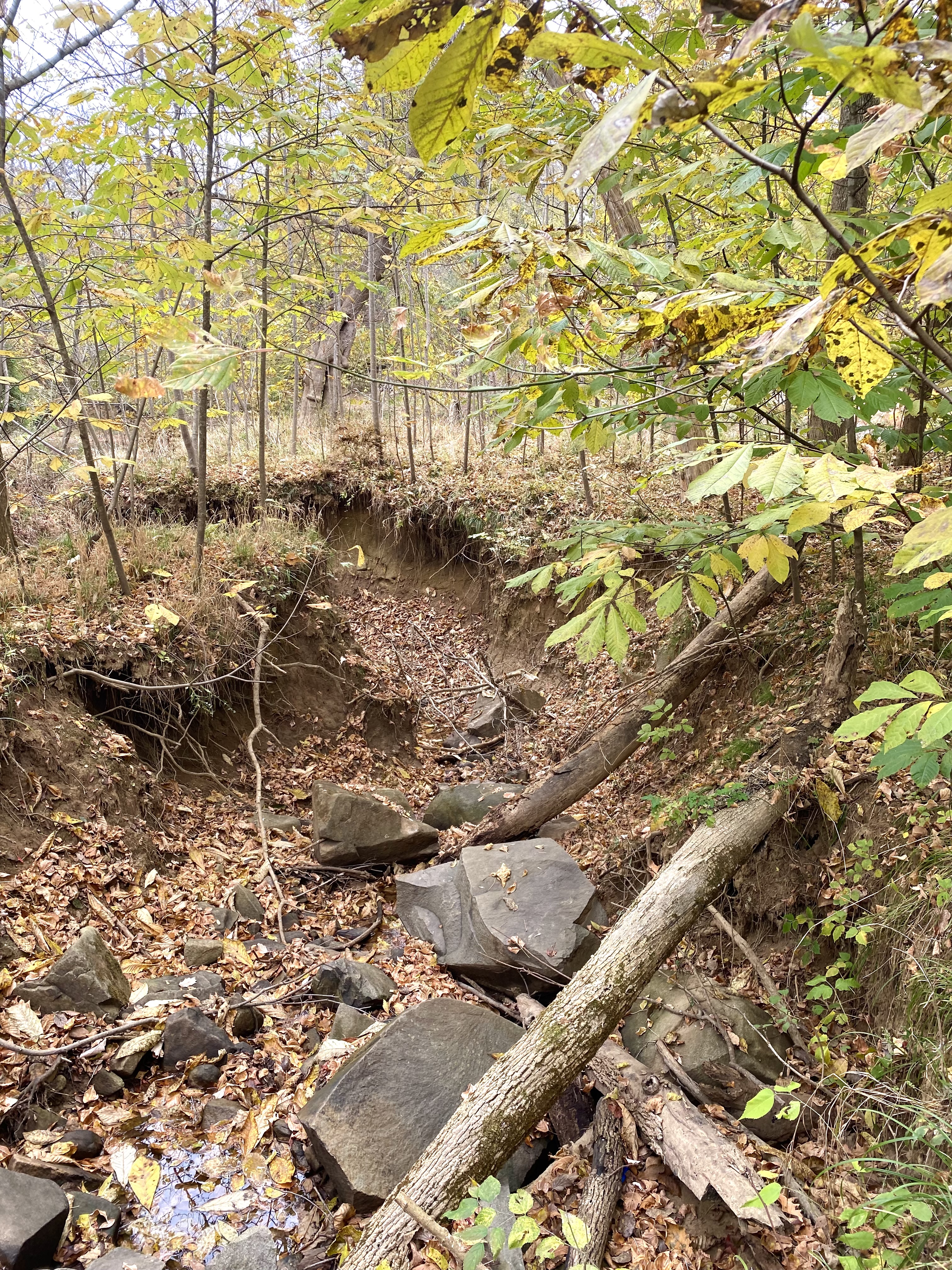
I walked farther along the path, hoping to find more ruins. While the depression that was the canal continues to wend and wind through the woods – including a portion with a stream running down the middle, I didn’t spot any more stone walls. However, several spots in what would have been the waterway have huge rocks that could have once been part of a structure now tumbled to pieces.
Ultimately, the fortunes of the canal didn’t pan out. By 1851, a series of locks and dams and canals had made Goose Creek navigable roughly to the Evergreen Mills Road area south of today’s Beaverdam Reservoir near Brambleton – far short of the 20 miles originally planned.
And the naysayers’ worries about the railroads had proven prescient. By the late 1850s, the canal project was languishing and in disrepair as new train tracks in Loudoun were stealing all enthusiasm for the waterway.
I, on the other hand, was feeling quite enthused over my exploration. After years of wondering about the ruins in the woods, I had made the hike out there, seen the local canal and locks for myself and touched the cool stones that were cut by unnamed – and, sadly, possibly unpaid – workers more than a century ago. It was local history come to life and a fall morning well spent.